Category:Wigmore, Luton
Jump to navigation
Jump to search
suburb and electoral ward in Luton, Bedfordshire, United Kingdom | |||||
| Upload media | |||||
| Instance of |
| ||||
|---|---|---|---|---|---|
| Location | Luton, Bedfordshire, East of England, England | ||||
 | |||||
Subcategories
This category has only the following subcategory.
L
Media in category "Wigmore, Luton"
The following 49 files are in this category, out of 49 total.
-
 0743 On the downwind leg, London (Luton) Airport - geograph.org.uk - 1832527.jpg 1,024 × 768; 106 KB
-
 Airport Way - geograph.org.uk - 571979.jpg 640 × 480; 93 KB
-
 Airport Way - geograph.org.uk - 571981.jpg 640 × 480; 84 KB
-
 Asda supermarket - geograph.org.uk - 1372858.jpg 640 × 480; 72 KB
-
 Ashcroft Road - geograph.org.uk - 1374448.jpg 640 × 480; 71 KB
-
 Ashcroft Road - geograph.org.uk - 1598478.jpg 640 × 480; 60 KB
-
 Ashcroft Road - geograph.org.uk - 1598484.jpg 640 × 480; 59 KB
-
 Ashcroft Road - geograph.org.uk - 1598488.jpg 640 × 480; 61 KB
-
 Churchfield Medical Centre - geograph.org.uk - 990131.jpg 640 × 480; 74 KB
-
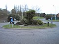 Creative planting on roundabout - geograph.org.uk - 397731.jpg 640 × 480; 132 KB
-
 Eaton Green footbridge - geograph.org.uk - 860286.jpg 640 × 480; 105 KB
-
 Eaton Green footbridge - geograph.org.uk - 860292.jpg 480 × 640; 111 KB
-
 Eaton Green footbridge - geograph.org.uk - 860294.jpg 640 × 480; 96 KB
-
 Eaton Green Road - geograph.org.uk - 1268128.jpg 640 × 480; 129 KB
-
 Eaton Green Road - geograph.org.uk - 1372793.jpg 640 × 459; 69 KB
-
 Eaton Green Road - geograph.org.uk - 1372848.jpg 640 × 480; 78 KB
-
 Eaton Green Road - geograph.org.uk - 1374494.jpg 640 × 480; 105 KB
-
 Eaton Green Road - panoramio.jpg 3,264 × 2,448; 3.1 MB
-
 Eaton Green roundabout - geograph.org.uk - 860266.jpg 640 × 480; 105 KB
-
 Eaton Green roundabout - geograph.org.uk - 860272.jpg 640 × 497; 111 KB
-
 Eaton Green roundabout - geograph.org.uk - 860302.jpg 480 × 640; 91 KB
-
 Entering Hertfordshire - geograph.org.uk - 946054.jpg 640 × 480; 67 KB
-

-
 Frank Lester Way - geograph.org.uk - 1268101.jpg 640 × 480; 117 KB
-
 Hedley Rise - geograph.org.uk - 1372855.jpg 640 × 480; 58 KB
-
 In Lalleford Road - geograph.org.uk - 990124.jpg 640 × 466; 76 KB
-
 Luton, Wigmore Arms - geograph.org.uk - 3841528.jpg 640 × 476; 86 KB
-
 Luton, Wigmore Hall - geograph.org.uk - 3841578.jpg 640 × 485; 59 KB
-
 Luton, Wigmore Place - geograph.org.uk - 3841522.jpg 640 × 480; 77 KB
-
 Park just off Eaton Green Road - panoramio.jpg 3,264 × 2,448; 3.02 MB
-
 Percival Road - geograph.org.uk - 1598465.jpg 640 × 480; 50 KB
-
 President Way - geograph.org.uk - 946358.jpg 640 × 480; 57 KB
-
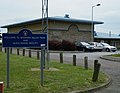
 Raynham Way Community Centre - geograph.org.uk - 1372787.jpg 640 × 480; 59 KB
-
 Roundabout at Wigmore Lane - geograph.org.uk - 1374359.jpg 640 × 480; 56 KB
-
 Roundabout at Wigmore Place - geograph.org.uk - 1372806.jpg 640 × 480; 54 KB
-
 Roundabout at Wigmore Valley Park - geograph.org.uk - 1372845.jpg 640 × 429; 48 KB
-
 Wigmore Church - geograph.org.uk - 990137.jpg 450 × 600; 47 KB
-
 Wigmore Lane - geograph.org.uk - 397725.jpg 640 × 480; 121 KB
-
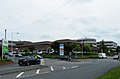
 Wigmore Park District Centre - geograph.org.uk - 1372862.jpg 640 × 391; 58 KB
-
 Wigmore Park District Centre - geograph.org.uk - 1372863.jpg 640 × 409; 51 KB
-
 Wigmore Park District Centre - geograph.org.uk - 1372867.jpg 640 × 420; 46 KB
-
 Wigmore Valley Park - geograph.org.uk - 1372815.jpg 640 × 480; 61 KB
-
 Wigmore Valley Park - geograph.org.uk - 1372831.jpg 640 × 480; 75 KB
-
 Wigmore Valley Park - geograph.org.uk - 1372838.jpg 640 × 480; 57 KB
-
 Wigmore Valley Park - geograph.org.uk - 1372839.jpg 640 × 480; 73 KB
-
 Wigmore Valley Park - geograph.org.uk - 1372843.jpg 640 × 497; 74 KB
-
 Luton, Buckingham Drive - geograph.org.uk - 295923.jpg 640 × 480; 89 KB
-
 Road construction site - geograph.org.uk - 571971.jpg 640 × 480; 125 KB
-
 Road construction site - geograph.org.uk - 571974.jpg 640 × 480; 102 KB
_Airport_-_geograph.org.uk_-_1832527.jpg)


